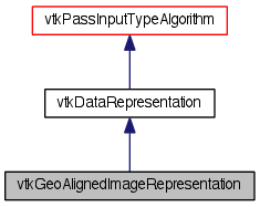
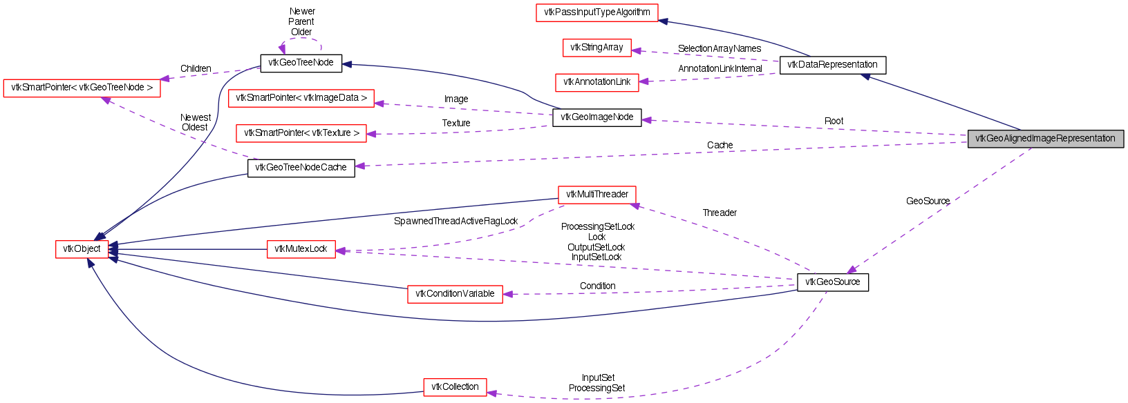
A multi-resolution image tree. More...
#include <vtkGeoAlignedImageRepresentation.h>


Public Types | |
| typedef vtkDataRepresentation | Superclass |
Public Member Functions | |
| virtual int | IsA (const char *type) |
| vtkGeoAlignedImageRepresentation * | NewInstance () const |
| void | PrintSelf (ostream &os, vtkIndent indent) |
| virtual vtkGeoImageNode * | GetBestImageForBounds (double bounds[4]) |
| void | SaveDatabase (const char *path) |
| virtual vtkGeoSource * | GetSource () |
| virtual void | SetSource (vtkGeoSource *source) |
Static Public Member Functions | |
| static vtkGeoAlignedImageRepresentation * | New () |
| static int | IsTypeOf (const char *type) |
| static vtkGeoAlignedImageRepresentation * | SafeDownCast (vtkObjectBase *o) |
Protected Member Functions | |
| virtual vtkObjectBase * | NewInstanceInternal () const |
| vtkGeoAlignedImageRepresentation () | |
| ~vtkGeoAlignedImageRepresentation () | |
| void | Initialize () |
| void | PrintTree (ostream &os, vtkIndent indent, vtkGeoImageNode *root) |
Protected Attributes | |
| vtkGeoImageNode * | Root |
| vtkGeoTreeNodeCache * | Cache |
| vtkGeoSource * | GeoSource |
| void | SetGeoSource (vtkGeoSource *source) |
Detailed Description
A multi-resolution image tree.
vtkGeoAlignedImageRepresentation represents a high resolution image over the globle. It has an associated vtkGeoSource which is responsible for fetching new data. This class keeps the fetched data in a quad-tree structure organized by latitude and longitude.
Definition at line 43 of file vtkGeoAlignedImageRepresentation.h.
Member Typedef Documentation
Reimplemented from vtkDataRepresentation.
Definition at line 47 of file vtkGeoAlignedImageRepresentation.h.
Constructor & Destructor Documentation
Member Function Documentation
| static vtkGeoAlignedImageRepresentation* vtkGeoAlignedImageRepresentation::New | ( | ) | [static] |
Create an object with Debug turned off, modified time initialized to zero, and reference counting on.
Reimplemented from vtkDataRepresentation.
| static int vtkGeoAlignedImageRepresentation::IsTypeOf | ( | const char * | name | ) | [static] |
Return 1 if this class type is the same type of (or a subclass of) the named class. Returns 0 otherwise. This method works in combination with vtkTypeMacro found in vtkSetGet.h.
Reimplemented from vtkDataRepresentation.
| virtual int vtkGeoAlignedImageRepresentation::IsA | ( | const char * | name | ) | [virtual] |
Return 1 if this class is the same type of (or a subclass of) the named class. Returns 0 otherwise. This method works in combination with vtkTypeMacro found in vtkSetGet.h.
Reimplemented from vtkDataRepresentation.
| static vtkGeoAlignedImageRepresentation* vtkGeoAlignedImageRepresentation::SafeDownCast | ( | vtkObjectBase * | o | ) | [static] |
Reimplemented from vtkDataRepresentation.
| virtual vtkObjectBase* vtkGeoAlignedImageRepresentation::NewInstanceInternal | ( | ) | const [protected, virtual] |
Reimplemented from vtkDataRepresentation.
Reimplemented from vtkDataRepresentation.
| void vtkGeoAlignedImageRepresentation::PrintSelf | ( | ostream & | os, |
| vtkIndent | indent | ||
| ) | [virtual] |
Methods invoked by print to print information about the object including superclasses. Typically not called by the user (use Print() instead) but used in the hierarchical print process to combine the output of several classes.
Reimplemented from vtkDataRepresentation.
| virtual vtkGeoImageNode* vtkGeoAlignedImageRepresentation::GetBestImageForBounds | ( | double | bounds[4] | ) | [virtual] |
Retrieve the most refined image patch that covers the specified latitude and longitude bounds (lat-min, lat-max, long-min, long-max).
| virtual vtkGeoSource* vtkGeoAlignedImageRepresentation::GetSource | ( | ) | [inline, virtual] |
The source for this representation. This must be set first before calling GetBestImageForBounds.
Definition at line 57 of file vtkGeoAlignedImageRepresentation.h.
| virtual void vtkGeoAlignedImageRepresentation::SetSource | ( | vtkGeoSource * | source | ) | [virtual] |
The source for this representation. This must be set first before calling GetBestImageForBounds.
| void vtkGeoAlignedImageRepresentation::SaveDatabase | ( | const char * | path | ) |
Serialize the database to the specified directory. Each image is stored as a .vti file. The Origin and Spacing of the saved image contain (lat-min, long-min) and (lat-max, long-max), respectively. Files are named based on their level and id within that level.
| void vtkGeoAlignedImageRepresentation::SetGeoSource | ( | vtkGeoSource * | source | ) | [protected] |
The source for creating image nodes.
| void vtkGeoAlignedImageRepresentation::Initialize | ( | ) | [protected] |
Initialize the representation with the current source.
| void vtkGeoAlignedImageRepresentation::PrintTree | ( | ostream & | os, |
| vtkIndent | indent, | ||
| vtkGeoImageNode * | root | ||
| ) | [protected] |
Print information about the image tree.
Member Data Documentation
vtkGeoSource* vtkGeoAlignedImageRepresentation::GeoSource [protected] |
The source for creating image nodes.
Definition at line 75 of file vtkGeoAlignedImageRepresentation.h.
vtkGeoImageNode* vtkGeoAlignedImageRepresentation::Root [protected] |
The root of the image tree.
Definition at line 79 of file vtkGeoAlignedImageRepresentation.h.
Definition at line 87 of file vtkGeoAlignedImageRepresentation.h.
The documentation for this class was generated from the following file:
- dox/Geovis/Core/vtkGeoAlignedImageRepresentation.h
 1.8.0
1.8.0