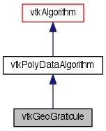
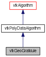
Create a polygonal lat-long grid. More...
#include <vtkGeoGraticule.h>


Detailed Description
Create a polygonal lat-long grid.
This filter generates polydata to illustrate the distortions introduced by a map projection. The level parameter specifies the number of lines to be drawn. Poles are treated differently than other regions; hence the use of a Level parameter instead of a NumberOfLines parameter. The latitude and longitude are specified as half-open intervals with units of degrees. By default the latitude bounds are [-90,90[ and the longitude bounds are [0,180[.
- Tests:
- vtkGeoGraticule (Tests)
Definition at line 44 of file vtkGeoGraticule.h.
Member Typedef Documentation
Reimplemented from vtkPolyDataAlgorithm.
Definition at line 49 of file vtkGeoGraticule.h.
Member Enumeration Documentation
Definition at line 64 of file vtkGeoGraticule.h.
Definition at line 104 of file vtkGeoGraticule.h.
Constructor & Destructor Documentation
| vtkGeoGraticule::vtkGeoGraticule | ( | ) | [protected] |
| virtual vtkGeoGraticule::~vtkGeoGraticule | ( | ) | [protected, virtual] |
Member Function Documentation
| static vtkGeoGraticule* vtkGeoGraticule::New | ( | ) | [static] |
Create an object with Debug turned off, modified time initialized to zero, and reference counting on.
Reimplemented from vtkPolyDataAlgorithm.
| virtual void vtkGeoGraticule::PrintSelf | ( | ostream & | os, |
| vtkIndent | indent | ||
| ) | [virtual] |
Methods invoked by print to print information about the object including superclasses. Typically not called by the user (use Print() instead) but used in the hierarchical print process to combine the output of several classes.
Reimplemented from vtkPolyDataAlgorithm.
| static int vtkGeoGraticule::IsTypeOf | ( | const char * | name | ) | [static] |
Return 1 if this class type is the same type of (or a subclass of) the named class. Returns 0 otherwise. This method works in combination with vtkTypeMacro found in vtkSetGet.h.
Reimplemented from vtkPolyDataAlgorithm.
| virtual int vtkGeoGraticule::IsA | ( | const char * | name | ) | [virtual] |
Return 1 if this class is the same type of (or a subclass of) the named class. Returns 0 otherwise. This method works in combination with vtkTypeMacro found in vtkSetGet.h.
Reimplemented from vtkPolyDataAlgorithm.
| static vtkGeoGraticule* vtkGeoGraticule::SafeDownCast | ( | vtkObjectBase * | o | ) | [static] |
Reimplemented from vtkPolyDataAlgorithm.
| virtual vtkObjectBase* vtkGeoGraticule::NewInstanceInternal | ( | ) | const [protected, virtual] |
Reimplemented from vtkPolyDataAlgorithm.
| vtkGeoGraticule* vtkGeoGraticule::NewInstance | ( | ) | const |
Reimplemented from vtkPolyDataAlgorithm.
| virtual void vtkGeoGraticule::SetLatitudeBounds | ( | double | , |
| double | |||
| ) | [virtual] |
The latitude bounds of the graticule.
| void vtkGeoGraticule::SetLatitudeBounds | ( | double | [2] | ) |
The latitude bounds of the graticule.
| virtual double* vtkGeoGraticule::GetLatitudeBounds | ( | ) | [virtual] |
The latitude bounds of the graticule.
| virtual void vtkGeoGraticule::GetLatitudeBounds | ( | double & | , |
| double & | |||
| ) | [virtual] |
The latitude bounds of the graticule.
| virtual void vtkGeoGraticule::GetLatitudeBounds | ( | double | [2] | ) | [virtual] |
The latitude bounds of the graticule.
| virtual void vtkGeoGraticule::SetLongitudeBounds | ( | double | , |
| double | |||
| ) | [virtual] |
The longitude bounds of the graticule.
| void vtkGeoGraticule::SetLongitudeBounds | ( | double | [2] | ) |
The longitude bounds of the graticule.
| virtual double* vtkGeoGraticule::GetLongitudeBounds | ( | ) | [virtual] |
The longitude bounds of the graticule.
| virtual void vtkGeoGraticule::GetLongitudeBounds | ( | double & | , |
| double & | |||
| ) | [virtual] |
The longitude bounds of the graticule.
| virtual void vtkGeoGraticule::GetLongitudeBounds | ( | double | [2] | ) | [virtual] |
The longitude bounds of the graticule.
| virtual void vtkGeoGraticule::SetLatitudeLevel | ( | int | ) | [virtual] |
The frequency level of latitude lines.
| virtual int vtkGeoGraticule::GetLatitudeLevel | ( | ) | [virtual] |
The frequency level of latitude lines.
| virtual void vtkGeoGraticule::SetLongitudeLevel | ( | int | ) | [virtual] |
The frequency level of longitude lines.
| virtual int vtkGeoGraticule::GetLongitudeLevel | ( | ) | [virtual] |
The frequency level of longitude lines.
| static double vtkGeoGraticule::GetLatitudeDelta | ( | int | level | ) | [inline, static] |
The latitude delta at a certain frequency level.
Definition at line 85 of file vtkGeoGraticule.h.
| static double vtkGeoGraticule::GetLongitudeDelta | ( | int | level | ) | [inline, static] |
The longitude delta at a certain frequency level.
Definition at line 91 of file vtkGeoGraticule.h.
| virtual void vtkGeoGraticule::SetGeometryType | ( | int | ) | [virtual] |
Set//get the type(s) of cells that will be output by the filter. By default, polylines are output. You may also request quadrilaterals. This is a bit vector of GeometryType enums.
| virtual int vtkGeoGraticule::GetGeometryType | ( | ) | [virtual] |
Set//get the type(s) of cells that will be output by the filter. By default, polylines are output. You may also request quadrilaterals. This is a bit vector of GeometryType enums.
| virtual int vtkGeoGraticule::RequestData | ( | vtkInformation * | request, |
| vtkInformationVector ** | inputVector, | ||
| vtkInformationVector * | outputVector | ||
| ) | [protected, virtual] |
This is called by the superclass. This is the method you should override.
Reimplemented from vtkPolyDataAlgorithm.
| void vtkGeoGraticule::GenerateGraticule | ( | vtkPolyData * | output, |
| double | latbds[2], | ||
| double | lngbds[2] | ||
| ) | [protected] |
| int vtkGeoGraticule::ComputeLineLevel | ( | int | ticId, |
| int | baseLevel, | ||
| const double * | levelIncrements | ||
| ) | [protected] |
Member Data Documentation
int vtkGeoGraticule::GeometryType [protected] |
Definition at line 114 of file vtkGeoGraticule.h.
double vtkGeoGraticule::LatitudeBounds[2] [protected] |
Definition at line 115 of file vtkGeoGraticule.h.
double vtkGeoGraticule::LongitudeBounds[2] [protected] |
Definition at line 116 of file vtkGeoGraticule.h.
int vtkGeoGraticule::LatitudeLevel [protected] |
Definition at line 117 of file vtkGeoGraticule.h.
int vtkGeoGraticule::LongitudeLevel [protected] |
Definition at line 118 of file vtkGeoGraticule.h.
double vtkGeoGraticule::LatitudeLevelTics[NUMBER_OF_LEVELS] [static, protected] |
The distance between tic marks at each level, in degrees.
Definition at line 122 of file vtkGeoGraticule.h.
double vtkGeoGraticule::LongitudeLevelTics[NUMBER_OF_LEVELS] [static, protected] |
The distance between tic marks at each level, in degrees.
Definition at line 123 of file vtkGeoGraticule.h.
The documentation for this class was generated from the following file:
- dox/Geovis/Core/vtkGeoGraticule.h
 1.8.0
1.8.0