Main Page Class Hierarchy Alphabetical List Compound List File List Compound Members File Members Related Pages
vtkDEMReader Class Reference
read a digital elevation model (DEM) file.
More...
#include <vtkDEMReader.h>
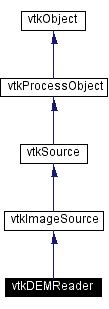
Inheritance diagram for vtkDEMReader:
 [legend]Collaboration diagram for vtkDEMReader:
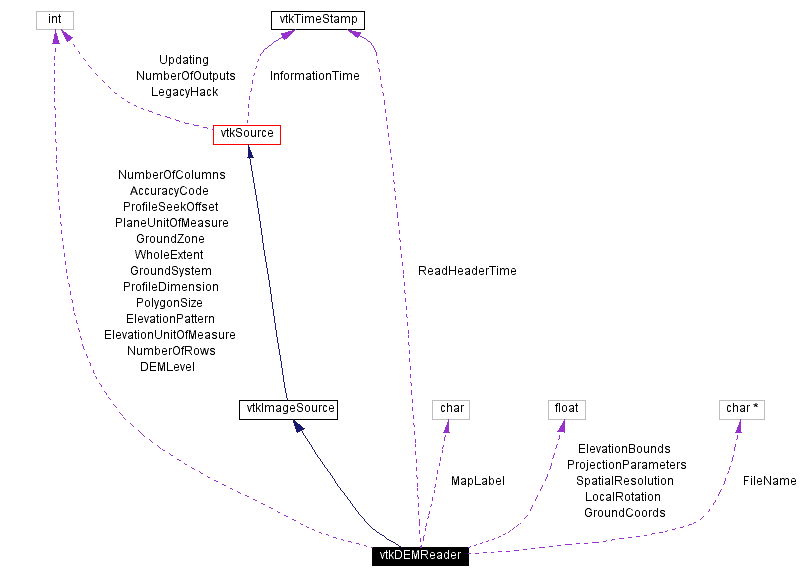 [legend]List of all members.
Detailed Description
read a digital elevation model (DEM) file.
-
Date:
-
2001/10/11 13:37:28
-
Revision:
-
1.24
vtkDEMReader reads digital elevation files and creates image data. Digital elevation files are produced by the US Geological Survey. A complete description of the DEM file is located at the USGS site. The reader reads the entire dem file and create a vtkImageData that contains a single scalar component that is the elevation in meters. The spacing is also expressed in meters. A number of get methods provide access to fields on the header.
-
Tests:
-
vtkDEMReader (Tests)
Definition at line 64 of file vtkDEMReader.h.
Constructor & Destructor Documentation
| vtkDEMReader::vtkDEMReader |
( |
|
) |
[protected] |
|
| vtkDEMReader::~vtkDEMReader |
( |
|
) |
[protected] |
|
Member Function Documentation
| vtkDEMReader* vtkDEMReader::New |
( |
|
) |
[static] |
|
|
|
Instantiate object with no start, end, or progress methods.
Reimplemented from vtkImageSource. |
| virtual const char* vtkDEMReader::GetClassName |
( |
|
) |
[virtual] |
|
| int vtkDEMReader::IsTypeOf |
( |
const char * |
type |
) |
[static] |
|
|
|
Return 1 if this class type is the same type of (or a subclass of) the named class. Returns 0 otherwise. This method works in combination with vtkTypeMacro found in vtkSetGet.h.
Reimplemented from vtkImageSource. |
| virtual int vtkDEMReader::IsA |
( |
const char * |
type |
) |
[virtual] |
|
|
|
Return 1 if this class is the same type of (or a subclass of) the named class. Returns 0 otherwise. This method works in combination with vtkTypeMacro found in vtkSetGet.h.
Reimplemented from vtkImageSource. |
| vtkDEMReader* vtkDEMReader::SafeDownCast |
( |
vtkObject * |
o |
) |
[static] |
|
|
|
Will cast the supplied object to vtkObject* is this is a safe operation (i.e., a safe downcast); otherwise NULL is returned. This method is defined in all subclasses of vtkObject with the vtkTypeMacro found in vtkSetGet.h.
Reimplemented from vtkImageSource. |
| void vtkDEMReader::PrintSelf |
( |
ostream & |
os, |
|
|
vtkIndent |
indent |
|
) |
[virtual] |
|
|
|
Methods invoked by print to print information about the object including superclasses. Typically not called by the user (use Print() instead) but used in the hierarchical print process to combine the output of several classes.
Reimplemented from vtkSource. |
| virtual void vtkDEMReader::SetFileName |
( |
const char * |
|
) |
[virtual] |
|
|
|
Specify file name of Digital Elevation Model (DEM) file |
| virtual char* vtkDEMReader::GetFileName |
( |
|
) |
[virtual] |
|
|
|
Specify file name of Digital Elevation Model (DEM) file |
| virtual char* vtkDEMReader::GetMapLabel |
( |
|
) |
[virtual] |
|
|
|
An ASCII description of the map |
| virtual int vtkDEMReader::GetDEMLevel |
( |
|
) |
[virtual] |
|
|
|
Code 1=DEM-1, 2=DEM_2, ... |
| virtual int vtkDEMReader::GetElevationPattern |
( |
|
) |
[virtual] |
|
|
|
Code 1=regular, 2=random, reserved for future use |
| virtual int vtkDEMReader::GetGroundSystem |
( |
|
) |
[virtual] |
|
|
|
Ground planimetric reference system |
| virtual int vtkDEMReader::GetGroundZone |
( |
|
) |
[virtual] |
|
|
|
Zone in ground planimetric reference system |
| virtual float* vtkDEMReader::GetProjectionParameters |
( |
|
) |
[virtual] |
|
|
|
Map Projection parameters. All are zero. |
| virtual void vtkDEMReader::GetProjectionParameters |
( |
float |
data[15] |
) |
[virtual] |
|
|
|
Map Projection parameters. All are zero. |
| virtual int vtkDEMReader::GetPlaneUnitOfMeasure |
( |
|
) |
[virtual] |
|
|
|
Defining unit of measure for ground planimetric coordinates throughout the file. 0 = radians, 1 = feet, 2 = meters, 3 = arc-seconds. |
| virtual int vtkDEMReader::GetElevationUnitOfMeasure |
( |
|
) |
[virtual] |
|
|
|
Defining unit of measure for elevation coordinates throughout the file. 1 = feet, 2 = meters |
| virtual int vtkDEMReader::GetPolygonSize |
( |
|
) |
[virtual] |
|
|
|
Number of sides in the polygon which defines the coverage of the DEM file. Set to 4. |
| virtual float* vtkDEMReader::GetElevationBounds |
( |
|
) |
[virtual] |
|
|
|
Minimum and maximum elevation for the DEM. The units in the file are in ElevationUnitOfMeasure. This class converts them to meters. |
| virtual void vtkDEMReader::GetElevationBounds |
( |
float |
data[2] |
) |
[virtual] |
|
|
|
Minimum and maximum elevation for the DEM. The units in the file are in ElevationUnitOfMeasure. This class converts them to meters. |
| virtual float vtkDEMReader::GetLocalRotation |
( |
|
) |
[virtual] |
|
|
|
Counterclockwise angle (in radians) from the primary axis of the planimetric reference to the primary axis of the DEM local reference system. IGNORED BY THIS IMPLEMENTATION. |
| virtual int vtkDEMReader::GetAccuracyCode |
( |
|
) |
[virtual] |
|
|
|
Accuracy code for elevations. 0=unknown accuracy |
| virtual float* vtkDEMReader::GetSpatialResolution |
( |
|
) |
[virtual] |
|
|
|
DEM spatial resolution for x,y,z. Values are expressed in units of resolution. Since elevations are read as integers, this permits fractional elevations. |
| virtual void vtkDEMReader::GetSpatialResolution |
( |
float |
data[3] |
) |
[virtual] |
|
|
|
DEM spatial resolution for x,y,z. Values are expressed in units of resolution. Since elevations are read as integers, this permits fractional elevations. |
| virtual int* vtkDEMReader::GetProfileDimension |
( |
|
) |
[virtual] |
|
|
|
The number of rows and columns in the DEM. |
| virtual void vtkDEMReader::GetProfileDimension |
( |
int |
data[2] |
) |
[virtual] |
|
|
|
The number of rows and columns in the DEM. |
| void vtkDEMReader::ExecuteInformation |
( |
|
) |
[virtual] |
|
|
|
Reads the DEM Type A record to compute the extent, origin and spacing of the image data. The number of scalar components is set to 1 and the output scalar type is VTK_FLOAT.
Reimplemented from vtkSource. |
| void vtkDEMReader::ComputeExtentOriginAndSpacing |
( |
int |
extent[6], |
|
|
float |
origin[6], |
|
|
float |
spacing[6] |
|
) |
[protected] |
|
| int vtkDEMReader::ReadTypeARecord |
( |
|
) |
[protected] |
|
| int vtkDEMReader::ReadProfiles |
( |
vtkImageData * |
data |
) |
[protected] |
|
| void vtkDEMReader::ExecuteData |
( |
vtkDataObject * |
out |
) |
[protected] |
|
Member Data Documentation
int vtkDEMReader::NumberOfColumns [protected]
|
|
int vtkDEMReader::NumberOfRows [protected]
|
|
int vtkDEMReader::WholeExtent[6] [protected]
|
|
char* vtkDEMReader::FileName [protected]
|
|
char vtkDEMReader::MapLabel[145] [protected]
|
|
int vtkDEMReader::DEMLevel [protected]
|
|
int vtkDEMReader::ElevationPattern [protected]
|
|
int vtkDEMReader::GroundSystem [protected]
|
|
int vtkDEMReader::GroundZone [protected]
|
|
float vtkDEMReader::ProjectionParameters[15] [protected]
|
|
int vtkDEMReader::PlaneUnitOfMeasure [protected]
|
|
int vtkDEMReader::ElevationUnitOfMeasure [protected]
|
|
int vtkDEMReader::PolygonSize [protected]
|
|
float vtkDEMReader::GroundCoords[4][2] [protected]
|
|
float vtkDEMReader::ElevationBounds[2] [protected]
|
|
float vtkDEMReader::LocalRotation [protected]
|
|
int vtkDEMReader::AccuracyCode [protected]
|
|
float vtkDEMReader::SpatialResolution[3] [protected]
|
|
int vtkDEMReader::ProfileDimension[2] [protected]
|
|
int vtkDEMReader::ProfileSeekOffset [protected]
|
|
The documentation for this class was generated from the following file:
Generated on Thu Mar 28 14:28:54 2002 for VTK by
 1.2.11.1 written by Dimitri van Heesch,
© 1997-2001
1.2.11.1 written by Dimitri van Heesch,
© 1997-2001